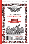
Almanack Sees Cooler Fall Weather for Mid-Atlantic, Northeast
FOR IMMEDIATE RELEASE...............
NEWS... NEWS... NEWS
HAGERSTOWN TOWN AND COUNTRY ALMANACK
BUY THE GENUINE ACCEPT NO OTHER!
(Mercersburg, PA. October 23, 2019) – The Hagerstown Town and Country Almanack’s weather prognosticator, Chad Merrill, issued this summary of October’s weather and the weather outlook for November today.Rain finally pushed into the parched Mid-Atlantic and Northeast in October. Washington, Baltimore, Philadelphia, Harrisburg, Pennsylvania, Hagerstown, Maryland., and Boston saw average rainfall. The storminess helped erase the "flash” drought in the Mid-Atlantic. A killing Autumn freeze ended the growing season across interior New England October 5 and west of Interstate 81 in the Mid-Atlantic on October 19th but has not yet occurred along or east of Interstate 81. Not to be outdone, Tropical Storm Nestor made landfall October 19 along the Florida Panhandle and then brought much-needed rain to the Mid-Atlantic on October 20. This exactly matches the forecast Weather Prognosticator Bill O’Toole predicted over one year ago!
In the near term, temperatures will get cold enough for scattered frost along the Interstate 81 corridor on Thursday morning, October 24. A pattern change will bring the first lake-effect snow showers of the season to the Alleghenies and interior New England through the first 5-10 days of November. Periodic cold fronts will bring brisk to occasionally gusty winds and below average temperatures to the Mid-Atlantic and Northeast during this time. We are forecasting a widespread freeze to end the growing season along and east of Interstate 81 between November 1-5 and the Mid-Atlantic and Northeast’s Interstate 95 corridor between November 15-20.
The jet stream will likely become more zonal after the middle of November and then likely head towards a north to south amplitude around Thanksgiving. The transition to a milder pattern will be brought on by a storm system that will likely bring rain around the middle of the month. Periods of colder than average weather return towards the end of the month. During these temperature transition phases, we expect periods of breezy to occasionally gusty winds. Although much-needed rain has occurred in the Mid-Atlantic and Northeast, we will still likely see relative humidity drop low enough on one or two occasions in November during windy days to warrant red flag, or increased fire danger conditions.
Looking ahead to the Thanksgiving holiday weekend, we expect a storm system earlier that week (November 25-27) to bring rain. This will be followed by cooler weather, brisk wind and occasional mountain and lake effect flurries or snow showers from the eastern Great Lakes to the Alleghenies and interior New England (west of the major cities) from Thanksgiving Day into Friday. High pressure will bring dry weather to conclude the holiday weekend and the month.
Stay tuned for the updated Winter 2019-2020 outlook next month. This will include a look at the spots that will see a White Christmas! Until then, the Hagerstown Town and Country Almanack Team wish you a Happy Halloween and blessed Thanksgiving.


