Hagerstown Almanack Issues Interim Forecast For December 2018 to March 2019
FOR IMMEDIATE RELEASE...............
NEWS... NEWS... NEWS
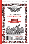
HAGERSTOWN TOWN AND COUNTRY ALMANACK
BUY THE GENUINE ACCEPT NO OTHER!
(Mercersburg, PA. December 14, 2018) – The Hagerstown Town and Country Almanack has issued an update to its forecast for the coming 2018-2019 winter. The Almanack’s weather prognosticator, Bill O’Toole, has compiled a concise summary of what to expect in the months ahead:
Summer and Autumn 2018 were particularly variable in temperature. Locally, in the Mid-Atlantic region, it was slightly cooler than normal in June, even cooler in July, but above normal in August. This was followed by much above normal in September and October, but much below normal in November. But in the Western States, nearly constant high temperatures helped to produce one of the worst wildfire years on record. California was especially hit hard with entire neighborhoods and cities wiped off the map.
Many regions in the East and South had much-above precipitation. It has been a very wet year. For example, Washington, D.C. marks 2018 as its wettest year on record. All indications are that it will continue to be very wet through the upcoming winter. A weak El Niño is developing; one result is that storms line up in the Pacific Ocean and, like a train, one by one they hit the West Coast and march across the country to the East Coast. Whether they produce rain or snow in any given area depends on the storm track and the availability of cold Canadian air.
One example of the perfect combination of moisture (from the Gulf of Mexico and the Western Atlantic Ocean) and cold temperatures occurred in the middle of November 2018 when the a "surprise” snowstorm struck the East Coast. It was a classic Nor’easter that buried some areas under two feet of snow, rather unusual for so early in the season, more than a month before astronomical winter begins. In fact, it was about the third or fourth Nor’easter since the start of October, but the first to produce widespread snow because of the cold air that was in place.
The most likely scenario for this winter in the Mid-Atlantic region is a continuation of the wet conditions, with one or more storms affecting the region every week. One respected source of long-range forecasts has predicted that the El Niño will cause multiple storms to track across the country throughout the season, and that at least some of them will become Nor’easters and bring heavy snow from the Mid-Atlantic to New England. Absent all other influences, the Hagerstown Almanack agrees with this forecast.
There are two inter-related flies in the ointment, however. One of those is the Polar Vortex and the other is the North Atlantic Oscillation (NAO). The latter is a measure of the relative positions of high and low pressure systems at high and low latitudes in the North Atlantic Ocean. When the NAO is negative, the door is opened for extremely cold Arctic Air to descend into eastern North America and Western Europe. In other words, the Polar Vortex moves down from the North Pole to take up residence over eastern North America. A positive NAO, on the other hand, closes this door and locks up the extreme cold in the far North.
Positive and negative phases of the NAO can last for a few days or a couple of months. An example of a long-lasting negative NAO occurred in the winter of 2009-2010, bringing record cold and snow to the Eastern Seaboard despite a strong El Niño. Up until the first several days of December, the NAO has been mostly in a small amplitude, not swinging wildly up or down. But that simply means that it can easily swing positive or negative, without much warning.
We will watch it closely to see if there is a trend either way. In the meantime, just expect the wet conditions to continue; whether it is rain or snow will depend on the availability of cold air. And that depends ultimately on the NAO.
Bill O'Toole, Prognosticator
Gruber Almanack, LLC


