Almanack Sees Snowy Winter For Mid-Atlantic, Northeast
FOR IMMEDIATE RELEASE...............
NEWS...NEWS...NEWS
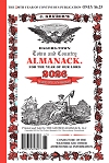
HAGERSTOWN TOWN AND COUNTRY ALMANACK
BUY THE GENUINE ACCEPT NO OTHER!
(Mercersburg, PA. November 6, 2019) – The Hagerstown Town and Country Almanack’s new weather prognosticator, Chad Merrill, and Weather Prognosticator Emeritus, Bill O’Toole issued an updated winter outlook for the Mid-Atlantic and Northeast today.The first half of December will see near average temperatures and several weather systems that will bring in quick-hitting snow but not any major winter storms. December 7-13 will likely be the snowiest period of the month. Another snow is possible between December 16-20 before a transition to slightly warmer than average temperatures is expected. Christmas Day is expected to be dry for the Mid-Atlantic and Northeast. East of the mountains in the Mid-Atlantic and Northeast, no White Christmas is expected, however, the Alleghenies, Adirondacks north to the Green and White Mountains will likely see lingering snow from earlier month snowfall to qualify as a White Christmas.
January will bring a return to near or slightly below average temperatures after the first of the year. A few stronger winter storms will bring above average snow to the Mid-Atlantic and Northeast. This includes the likelihood of a Nor’easter, with the best chance in the middle of January. There will be windy periods in the wake of each winter storm that will contribute to cold wind chills.
Ultimately, the biggest snowstorms of the season will occur in February and March. Mid-February and mid-March are key dates for one or two Nor’easters or potential blizzards. February will also see several cold snaps with gusty winds, dangerous wind chills at times, especially surrounding the winter storms that occur. An ice storm or two is also in the forecast this winter, the best chance between mid-January and mid-March. These ice storms will primarily impact locations west of Interstate 95 (New England and the Mid-Atlantic) and east of Interstate 79 (in the Mid-Atlantic).
The last snow of the winter season will likely occur in late March or early April for the Mid-Atlantic and early April for the Northeast.
Snow totals for the winter season will likely exceed the 1981-2010 averages, which are 27.2 inches for Hagerstown, Md., 78-90 inches for the Alleghenies, 15 inches for Washington, D.C., 27 inches for Morgantown, W.Va., 40 inches for Pittsburgh and 42 inches for Boston.
The large-scale patterns impacting this winter include a Neutral ENSO (El Nino Southern Oscillation), which typically brings Canadian air south into the Great Lakes and Northeast. The subtropical jet stream in a Neutral ENSO typically transports moisture north into the East. The end result is a high frequency of winter storms that track either from Alberta, Canada into the Northeast, known as "Albert Clippers” or southern tracking storms that originate in the southern Plains or near the Gulf Coast and track north and east into interior New England or along the coast (Nor’easters). Another factor impacting this winter’s temperature outcome is the Quasi-Biennial Oscillation, which is a cyclical wind in the stratosphere above the equator that spreads into the higher latitudes. Right now, the wind is in a westerly direction but will likely become easterly late this winter. An easterly wind is more apt to weaken the polar vortex and allow cold air to spill occasionally into North America. These cold outbreaks bring temperatures well-below average for about a week or two.
A third factor, which will have the most influence for the first two weeks of December, is snow cover in northern Asia. Above average snow cover has been linked to producing strong Canadian high pressure systems that nose into the Eastern U.S. and bring cold weather. Finally, we are in a sunspot minimum cycle and this tends to produce large fluctuations or amplitudes in the jet stream. Given the typical Neutral ENSO that will carry through the winter, the jet stream will likely dip into the East frequently and that will contribute to near or cooler than average temperatures.
Chad Merrill, Prognosticator
Bill O’Toole, Prognosticator Emeritus
Gruber Almanack, LLC


